Question 1.
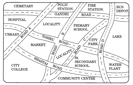
Look at the given map of a city.
Answer the following.
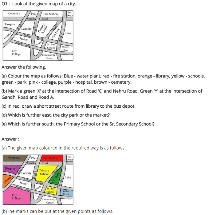
(a) Colour the map as follows: Blue-water, red- fire station, orange-library, yellow-schools, Green-park, Pink-College, Purple-Hospital, Brown-Cemetery.
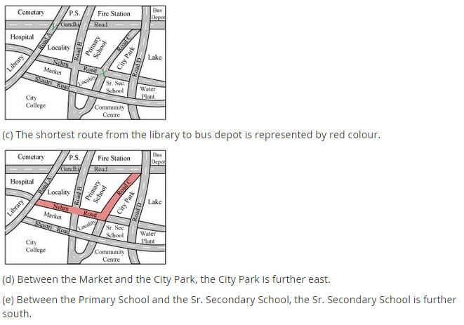
(b) Mark a green ‘X’ at the intersection of Road ‘C’ and Nehru Road, Green ‘Y’ at the intersection of Gandhi Road and Road A.
(c) In red, draw a short street route from Library to the bus depot.
(d) Which is further east, the city park or the market?
(e) Which is further south, the primary school or the Sr. Secondary School?
Question 2.
Draw a map of your classroom using proper scale and symbols for different objects.
Question 3.
Draw a map of your school compound using proper scale and symbols for various features like a playground, main building, garden etc.
Question 4.
Draw a map giving instructions to your friend so that she reaches your house without any difficulty.
Solution:
Question 1 to Question 4 each all activities. You can try yourself.

